 Catàleg IDEC
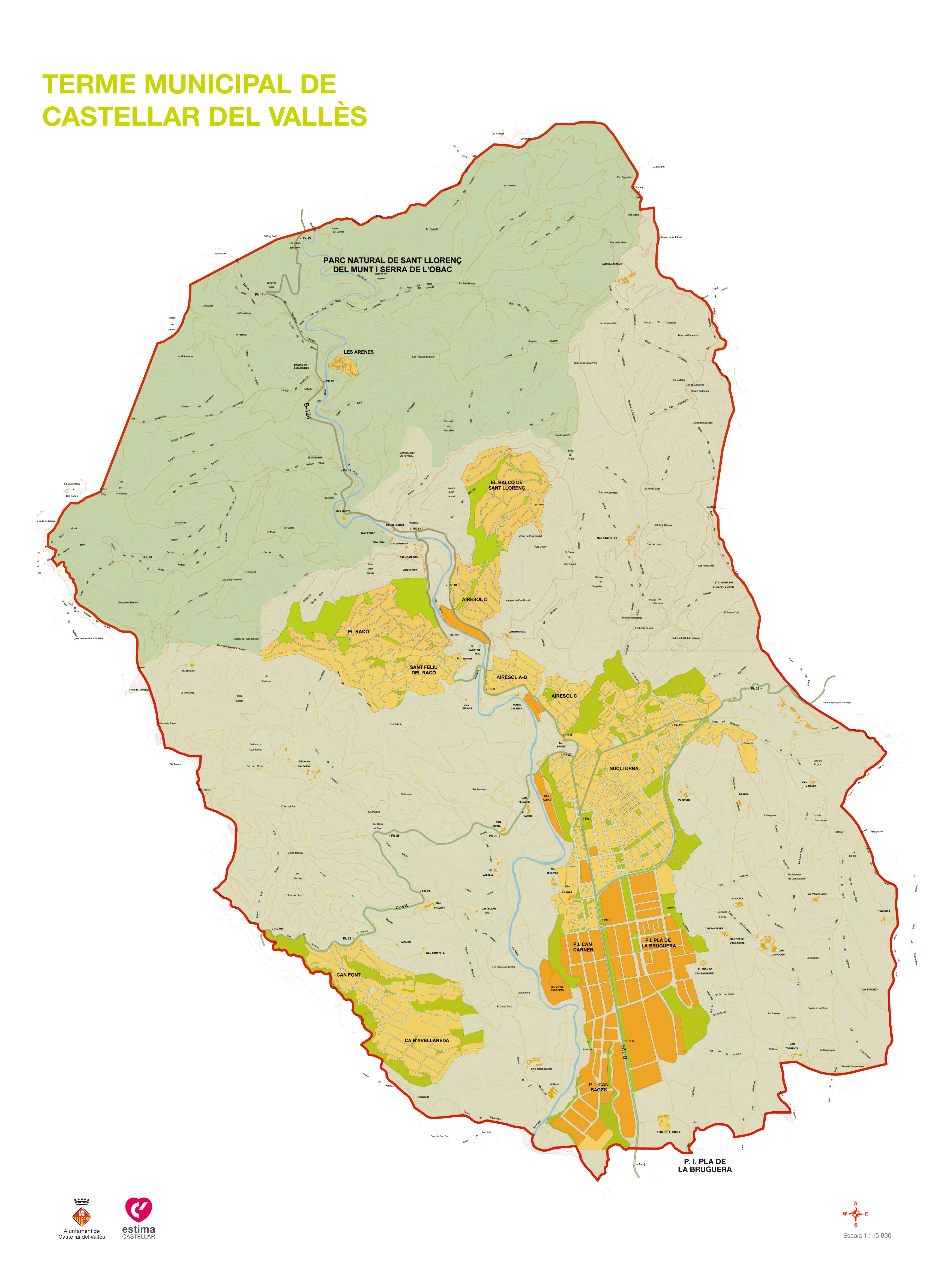
Local government area of Castellar del Vallès
Local government area of Castellar del Vallès is a set of cartographic information that represents the complete delimitation of the municipality. Formed by a topographic map, the data represented in 2D of scale 1:15000 locate the different settlements of Castellar del Vallès, with other information of interest, such as roads, rivers, and important places of the municipality.
Simple
- Date (Creation)
- 2020-01-29
- Identifier
- IDEC / terme-municipal-castellar-valles
- Maintenance and update frequency
- As needed
- GEMET - INSPIRE themes, version 1.0
-
- Land cover
- Transport networks
- Keywords
-
- Municipality
- Castellar del Vallès
- Human settlement
- Road setting
- Access constraints
- Other restrictions
- Other constraints
- No limitations
- Use constraints
- Other restrictions
- Other constraints
- http://www.castellarvalles.cat/33055/descriptiu/
- Spatial representation type
- Vector
- Denominator
- 15000
- Metadata language
- Catalan; Valencian
- Topic category
-
- Imagery base maps earth cover
- Location
- Boundaries
N
S
E
W
))
- Begin date
- 2020-01-29
- End date
- 2020-01-29
- Reference system identifier
- Desconegut
- Distribution format
-
-
PDF
(
)
- Specification
- -
-
PDF
(
)
- OnLine resource
-
Data downloader
Downloading data in several files in JPEG format.
- Hierarchy level
- Dataset
Domain consistency
- Name of measure
- Compliance with INSPIRE requirements (data)
- Evaluation method description
- The data of this dataset do not aim to achieve compliance with INSPIRE regulations. For this reason, its conformity is not evaluated and it is declared not conformant compliant by default.
Conformance result
Domain consistency
- Name of measure
- Compliance with INSPIRE requirements (metadata)
- Evaluation method description
- The compliance of the metadata is evaluated using the "INSPIRE Reference Validator" web tool. The metadata is considered correct when the only errors reported are related with the main language of the metadata file. These errors are due to the fact that Catalan is not included in the list of official languages of the European Union.
Conformance result
- Statement
- To know the processes, parameters and data sources used to obtain the data set, contact the distributor organization.
- Description
- To know the main source of information used to obtain the dataset contact to the distributor organization.
- Included with dataset
- No
- File identifier
- terme-municipal-castellar-valles XML
- Metadata language
- Catalan; Valencian
- Hierarchy level
- Dataset
- Date stamp
- 2020-02-04T16:30:03
- Metadata standard name
- ISO 19115
- Metadata standard version
- 2003/Cor.1:2006 Geographic Information - Metadata
Overviews
Spatial extent
N
S
E
W
Provided by

Associated resources
Not available