 Catàleg IDEC
Metropolitan topobathymetric cartography
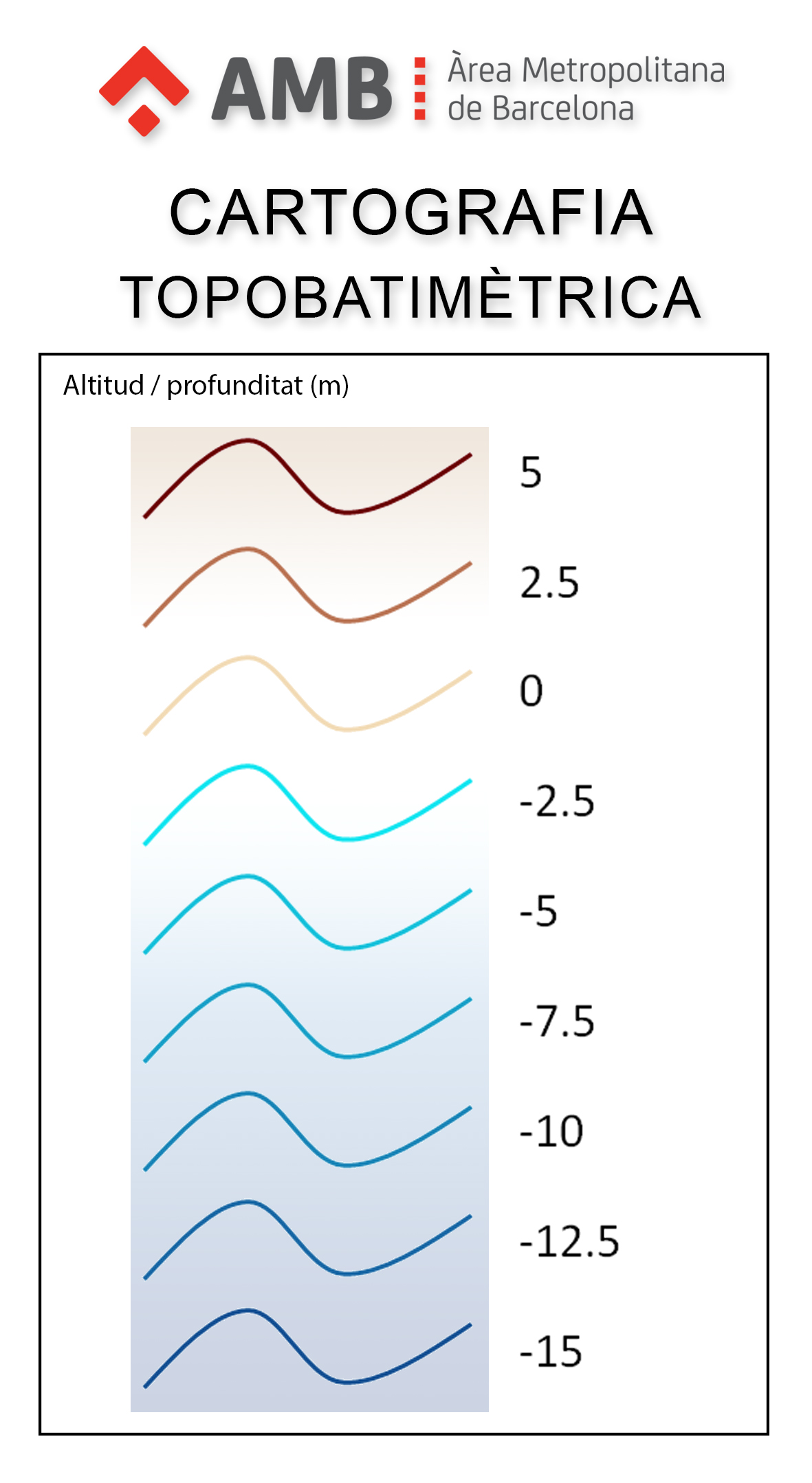
Metropolitan topobathymetric cartography is a representation of the surface of the coastal strip, both the surface (dry beach) and the submerged part, to an approximate depth of between 15 and 20 meters. The depth is represented in the surface part with contour lines and in the submerged part with isobaths, both with an equidistance of 0.5 meters. No planimetric element is represented, only the relief of the seabed.
Simple
- Date (Revision)
- 2024
- Identifier
- IDEC / cartografia-topobatimetrica-metropolitana
- Purpose
- To have the topobathymetric cartography of the beaches of the metropolitan area of Barcelona with the aim, among others, of monitoring the dynamics of the coastline.
- IDEC - llocs
-
- Metropolitan Area of Barcelona
- Catalonia
- Spain
- Europe
- IDEC - temes
-
- Hub litoral
- SIDL
- Access constraints
- Other restrictions
- Other constraints
- No limitations
- Use constraints
- Other restrictions
- Other constraints
- Creative Commons Attribution 4.0 International (CC BY 4.0)
- Spatial representation type
- Vector
- Distance
- 50 cm
- Metadata language
- Catalan; Valencian
- Character set
- UTF8
- Topic category
-
- Elevation
- Description
- The spatial extension covers the entire metropolitan coastal strip. Temporal extent refers to the dates of the data source.
N
S
E
W
))
- Begin date
- 2023-05
- End date
- 2024-05
Vertical extent
- Minimum value
- -20
- Maximum value
- 5
Vertical CS
No information provided.
Vertical datum
No information provided.
- Unique resource identifier
- ETRS89 UTM zone 31 North (EPSG:25831)
- Reference system identifier
- Altitudes referred to mean sea level in Alacant and using the geoid EGM08D595.
- Units of distribution
- The data is distributed by municipalities.
- OnLine resource
- Data visualization and download
- OnLine resource
- Data legend
- OnLine resource
- Coverage and date source information
- OnLine resource
- Technical specifications
- Hierarchy level
- Dataset
Domain consistency
- Name of measure
- Compliance with INSPIRE requirements (data)
- Evaluation method description
- The data of this dataset do not aim to achieve compliance with INSPIRE regulations. For this reason, its conformity is not evaluated and it is declared not conformant compliant by default.
Conformance result
Domain consistency
- Name of measure
- Compliance with INSPIRE requirements (metadata)
- Evaluation method description
- The compliance of the metadata is evaluated using the "INSPIRE Reference Validator" web tool. The metadata is considered correct when the only errors reported are related with the main language of the metadata file. These errors are due to the fact that Catalan is not included in the list of official languages of the European Union.
Conformance result
- Statement
- The topobathymetric survey from which this cartography was drawn uses three different data capture techniques: topographic survey, bathymetric survey with single-beam echosounder and bathymetric survey with multi-beam echosounder. The characteristics of these techniques are detailed in the technical specifications.
- Description
- Topographic survey
- Description
- Single-beam echosounder
- Description
- Multi-beam echosounder
- File identifier
- cartografia-topobatimetrica-metropolitana XML
- Metadata language
- Catalan; Valencian
- Character set
- UTF8
- Hierarchy level
- Dataset
- Date stamp
- 2025-10-27
- Metadata standard name
- IDEC profile of metadata of spatial datasets
- Metadata standard version
- Version 5.0
Overviews

Spatial extent
N
S
E
W
Provided by

Associated resources
Not available